|
Versamap for Windows 3.01
Program Specifications
|
|
| Version: |
3.01
|
| Size: |
3.98 MB |
| Publisher: |
Versamap |
| Date Added: |
Aug 9, 2005 |
| License [?]: |
Shareware (USD$30.00 to buy) |
| Operating System: |
Windows XP, Windows Vista, Windows 2003, Windows 2000 |
| Requirements: |
|
| Download Links: |
Download Versamap for Windows
|
BumperSoft Editor's Review Status:
|
|
|
|
Publisher's Description of Versamap for Windows
|
" Draws outline maps on 14 projections and exports maps as BMP, WMF, CGM, DXF, ASCII files. "
- From Versamap
Versamap draws outline maps on 16 map projections. The program allows users to print publication quality maps; and to export maps in vector graphic (WMF, CGM, DXF, ASCII) and bitmapped (BMP) formats.
Versamap is supplied with digital maps from the Versamap Micro World Database, a world map with 220,000 points in 10 geographic features.
Versamap may be ordered with more detailed digital maps from:
(1) World Data Bank II, a world map with 6 million points in 36 geographic features; and from the
(2) USGS Digital Line Graphs, a map of the 50 United States with 7 million points in 72 geographic features.
Individual geographic features, such as coastlines, rivers, islands, and political boundaries, can be plotted from these digital map databases.
The program allows users to plot their own data (as lines or symbols) in a simple ASCII format, and to display labels next to their data points.
Text may be added to maps with any TrueType font. Each text string can have a different font, and can be rotated in 1 degree increments.
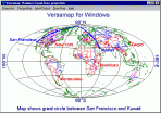
Versamap plots great circles between user selected endpoints, and displays course and distance at points along the great circle. You map print a Great Circle Report listing the course and distance at way points along the great circle, or save the report as a rich text file (RTF).
The program plots small circles around a user selected point. You may select the number of concentric small circles to be plotted, and the distance between small circles.
Versamap displays map parameters and scale errors at selected points on the map. You may print the Map Parameter Report, or save the report as a rich text file (RTF).
Versamap is designed to plot outline maps of areas larger than about 200 miles (320 km) on a side. The program is not designed to plot maps of small areas, such as city maps.
Versamap requires Windows 2000 or higher, and has an uninstall option.
PRODUCT NOTE:
Versemap is no longer being distributed with effective September 2009.
|
Share Versamap for Windows with Friends
Tags
|
RELATED DOWNLOADS
(Science and Engineering)
|
WEEK'S TOP DOWNLOADS
(All Categories)
|
|